
Reviewed · SERRA MALAGUETA NATURAL PARK
Serra Malagueta Natural Park: Hike to Gongon Valley & Lunch
Mountain paths reward strong legs. This Serra Malagueta outing gives you big mountain views and a real look at life in Santiago’s remote valleys, not just a bus ride to a viewpoint. I like the one-way route, which keeps the scenery changing, and the stop for lunch with a local family. My main concern is the pace: this is a difficult 12.5-kilometer hike, and one guide reportedly pushed through it in about three and a half hours.
You start high, around 1,000 meters above sea level, then walk downhill through the park and into the Gongon and Hortelã valleys. That makes the route scenic but demanding, with about 580 meters of climbing and roughly 1,100 meters of descent. Good shoes, water, and walking poles are not optional extras here, especially in hot or wet weather.
In This Review
- Key points at a glance
- From Praia to the Serra Malagueta highlands
- The trail profile: 12.5 kilometers with a long descent
- Plants, birds, and the first mountain views
- Passing deserted villages and meeting mountain families
- Gongon Valley and the local lunch stop
- Hortelã Valley and the final stretch
- Guides, pace, and group comfort
- Heat, rain, and what to pack
- Is the $106 price fair?
- Who will enjoy this Serra Malagueta hike?
- Should you book it?
- FAQ
- Where does the Serra Malagueta hike take place?
- How long is the trail?
- How long do you walk?
- How difficult is the hike?
- What is the highest point?
- How much elevation do you lose?
- Is the trail a loop?
- What does the lunch include?
- Is the park entrance fee included?
- What should you bring?
Key points at a glance
- A high-start, one-way hike: Begin near 1,035 meters and finish around 110 meters, so you see several sides of Santiago without retracing your steps.
- A local-family lunch: The meal is intended to take place at a local home, with a sandwich, fruit, juice, or a local dish depending on the arrangements.
- Remote valley life: You pass deserted villages and meet families living in mountain communities far from Praia.
- Wildlife and native plants: Keep watch for vervet monkeys, gray-headed kingfishers, and endemic plants along the trail.
- A serious physical outing: Plan on four to five hours of walking over steep sections, heat, mud, and uneven ground.
- Useful hotel service: Pickup and drop-off at your Praia accommodation are included, along with transport, a guide, lunch, and liability insurance.
From Praia to the Serra Malagueta highlands
The day begins with pickup at your accommodation in Praia. Transport is included, so you do not need to arrange a taxi to the trailhead or figure out the mountain roads yourself. The drive also gives you a useful change of scene, taking you away from the capital and toward the cooler, higher interior of Santiago.
The hike begins at about 1,000 meters above sea level, with the maximum point listed at roughly 1,035 meters. That starting height matters. You are not spending the first hour grinding uphill from sea level. Instead, the route starts among the higher ridges and gradually works down toward the valleys.
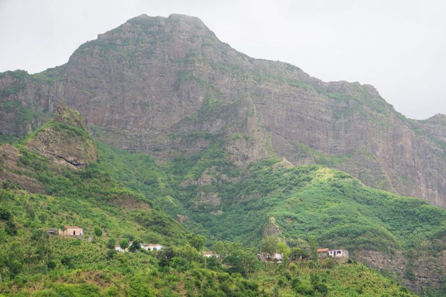
Serra Malagueta Natural Park is known here for its plant life, jagged hills, and wide views across Santiago. The park is not a polished garden with marked stops every few minutes. You should expect a natural mountain path, with flat stretches mixed with steep downhill sections.
The park entrance fee is not included. Bring €2 per person in cash for the charge. It is a small extra, but remembering it saves a last-minute scramble at the start.
More Hikes in Santiago
- Serra Malagueta: Principal Valley Hike & Lunch with Locals
★ 4.7 · 64 reviews - Praia: Baobab Mysterious Tree, Green Valley & Old City Hike
★ 4.8 · 53 reviews - Santiago: Calabaceira Valley Trek & Visit to Cidade Velha
★ 4.8 · 49 reviews
The trail profile: 12.5 kilometers with a long descent
The numbers tell you more than the cheerful phrase nature walk. The route is about 12.5 kilometers, with four to five hours of walking. The listed elevation gain is approximately 580 meters, while the elevation loss is about 1,100 meters.
That is a lot of downhill. Many people assume a downhill hike is easy, but steep descents can be harder on knees, ankles, and thighs than a steady climb. One account described the outing as strenuous in the heat, with sore muscles afterward. Another found it invigorating and manageable. Both reactions make sense: fitness, weather, footwear, and group pace will shape your day.
The route is classified as difficult. Some sections are flat, but much of the descent is steep. The path is described as safe, yet safe does not mean effortless. You need balance and steady footing, particularly if rain has made the ground muddy.
I would bring walking sticks or trekking poles. They help with braking on downhill sections and give you a third point of contact on loose or slippery ground. Wear proper hiking shoes with a firm sole, not casual trainers. Hiking pants are strongly advised from August through November, when vegetation and trail conditions can make shorts less comfortable.
Plants, birds, and the first mountain views
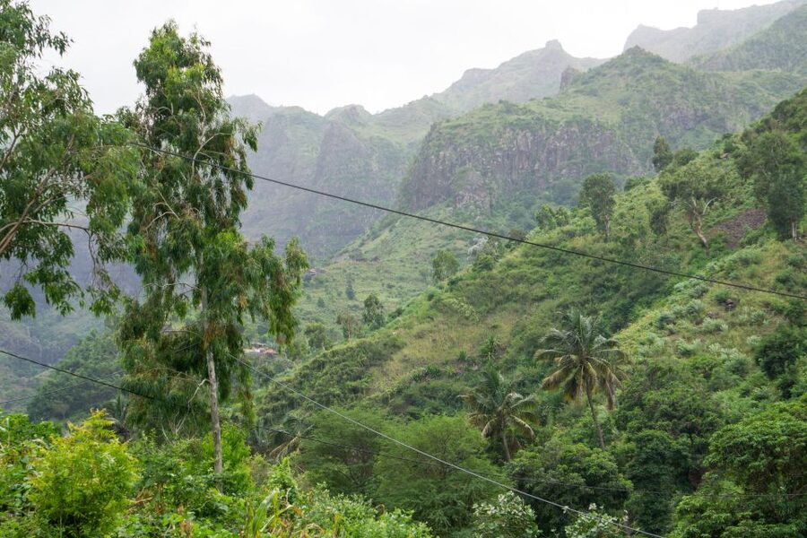
The upper part of the route takes you through Serra Malagueta’s native plant areas. The tour specifically points to endemic plants, so this is a good chance to pay attention to what grows on Santiago rather than treating the walk as scenery only.
Keep your eyes open for vervet monkeys and gray-headed kingfishers. Wildlife sightings are never guaranteed, but the setting gives you a reasonable reason to look up from the path. A guide can also help you notice small details that are easy to miss when you are watching your feet.
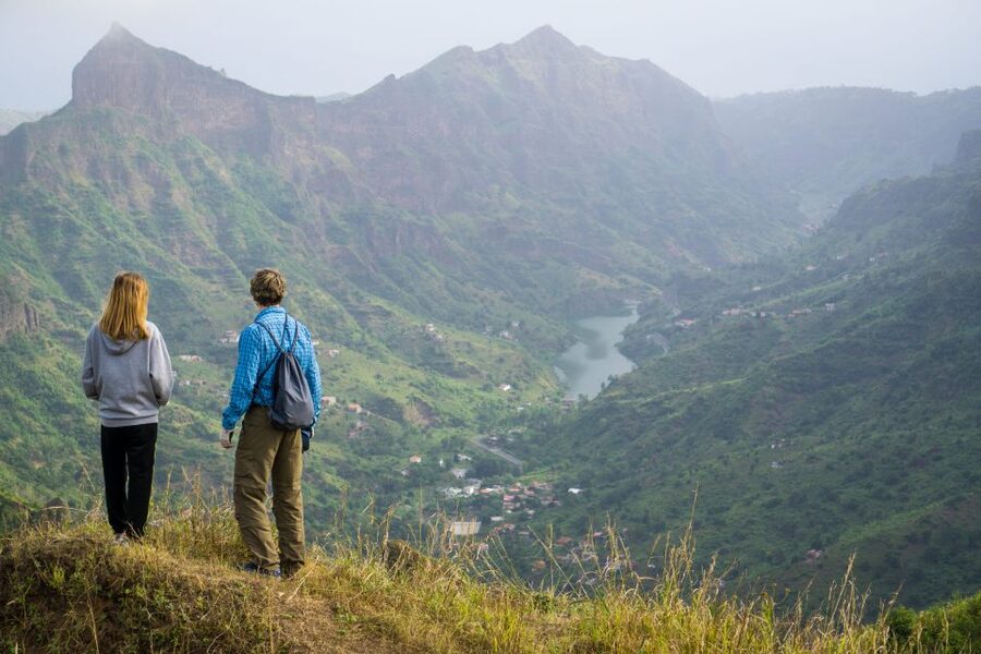
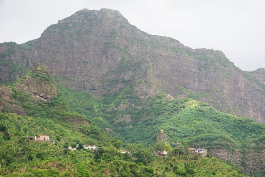
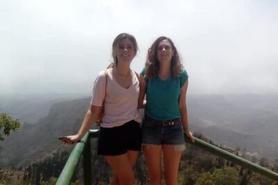
The views are one of the strongest reasons to book this experience. From the high ridges, you can look across sharp hills and folds of green, then watch the surroundings change as you descend. The route gains variety because it does not finish where it starts.
There is a practical catch. The best views require attention and energy. If your group moves too quickly, you may feel pressure to keep up instead of stopping to appreciate the scenery. Before setting out, tell your guide if you need a slower, steady pace. A beautiful trail is less enjoyable when you are trying to chase someone several minutes ahead.
Passing deserted villages and meeting mountain families
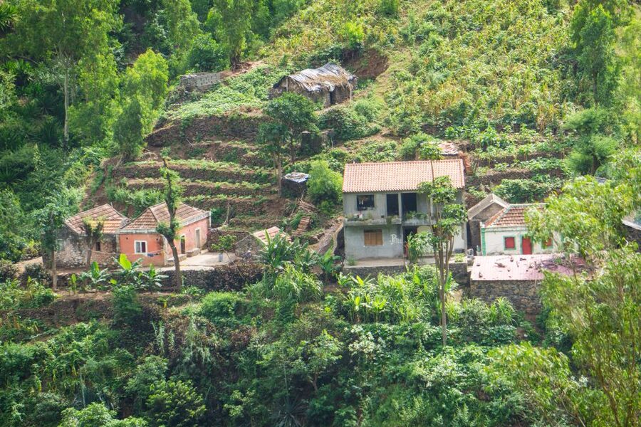
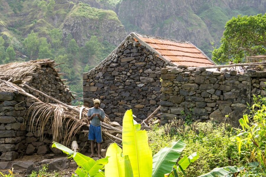
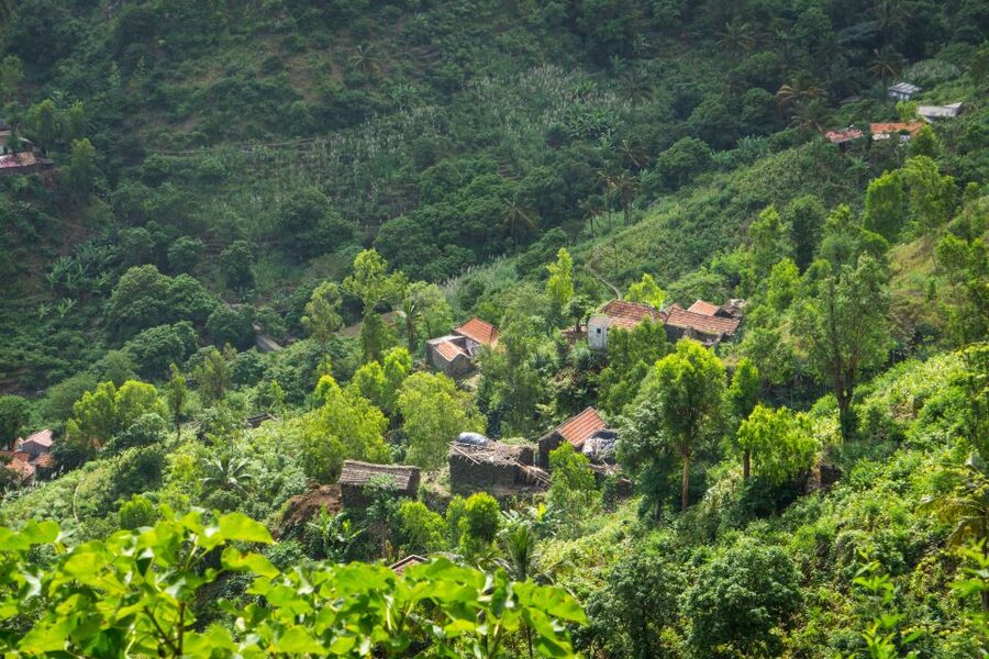
The walk becomes more personal as it leaves the upper park and reaches the remote valleys. You pass deserted villages and meet local families, learning about how people live in mountain areas away from Praia.
This part gives the day more purpose than a standard countryside walk. You are not only looking at hills. You are seeing how settlements, homes, and family life fit into a difficult highland environment. The experience may be especially meaningful if you want contact with everyday Cape Verdean life rather than a packaged resort activity.
The exact depth of this contact depends on the guide and the families available that day. Reports about guides were mostly warm, with Jose praised for explaining more than expected and Katia or Cati described as kind and attentive. Names and arrangements can vary, but the useful lesson is clear: the guide matters here.
A good guide keeps the group together, explains the area, and notices when someone is struggling. One account described a guide walking far ahead and missing falls, which is a serious warning on a difficult trail. I would treat group care as just as important as historical or botanical information when choosing this outing.
More Serra Malagueta hikes:
- Serra Malagueta Natural Park Hike & Relaxing Swim at Tarrafal Beach
★ 5.0 · 30 reviews - Santiago: Trek from Serra Malagueta to Rabelados Community
★ 5.0 · 16 reviews - Hikking Natural Park/Serra Malagueta
★ 4.0 · 4 reviews - Santiago Island: Trek from Serra Malagueta to Rabelados Community
★ 5.0 · 2 reviews
Gongon Valley and the local lunch stop
The route crosses Gongon Valley before continuing toward Hortelã Valley. These valley sections provide a strong contrast with the higher park. The air, vegetation, settlements, and sense of space change as you lose altitude.
Lunch is meant to be more than a quick snack. The planned picnic includes juice, fruit, and a sandwich, while some arrangements have included a meal at a local family’s home with a traditional local dish. One particularly positive account praised the food served at Hermiña’s home.
You should keep expectations flexible. The food experience may depend on the day’s host and the guide’s arrangements. One person reported only a quick stop to eat papaya rather than the promised picnic. That does not cancel out the many positive meal reports, but it is worth knowing before you pay for a full restaurant-style lunch.
The local-home setting is valuable because it connects the food to the people and place. It also means the stop may be simple. You are visiting a family home in a rural valley, not entering a formal café with a fixed menu and timed service.
Bring your own water and a small backup snack. Water is specifically listed among the items to bring, and a little extra food is sensible on a difficult hike. Do not count on the included lunch to replace your personal supplies for the entire day.
Hortelã Valley and the final stretch
After Gongon Valley, the route continues east to Hortelã Valley. By this point, the downhill mileage begins to matter. Your legs may feel tired even though you are no longer climbing much.
The final valley section is part of what makes this a one-way hike rather than a simple park loop. You get a gradual story of Santiago’s interior: high ridges, native plants, open slopes, remote villages, family homes, and lower valley terrain.
The route ends at a lower elevation, around 110 meters. From there, transport returns you to your accommodation in Praia. That pickup service is a real advantage after four or five hours on your feet. You do not need to find your way back to the capital on public transport while tired and dusty.
Guides, pace, and group comfort
The guiding team can make or break this outing. Positive feedback highlights friendly, caring guides and a strong driver. Jose received praise for sharing extra information, while Katia or Cati was described as exceptionally kind. The driver also received credit for making the day run smoothly.
Still, the reported pace problem deserves attention. A 12-kilometer mountain route completed in about three and a half hours may suit a strong hiker, but it can be too fast for a mixed group. The advertised walking time is four to five hours, and that longer window is more realistic for people who want safe footing and time for views.
The shared-group option requires at least two participants. If that minimum is not reached, the provider may offer another date, charge an extra fee to operate privately, or cancel with a full refund. That condition is worth checking if your schedule is tight.
The tour is offered in English, Portuguese, French, and Spanish. Confirm that your preferred language is available when booking, particularly if detailed explanations about plants and local life are important to you.
Heat, rain, and what to pack
Santiago’s mountain conditions can change the feel of the trail. Heat makes the long descent tiring, while rain can turn steep sections muddy and slippery. A September account specifically described wet conditions and advised bringing a small windbreaker.
Your daypack should include:
- Hiking shoes with good grip
- Walking sticks or trekking poles
- Water
- Sunscreen
- A hat
- Hiking pants, especially from August through November
- A light windbreaker in case of rain
- €2 for the park fee
Pack light, but do not cut the basics. You need enough water for a four-to-five-hour walk, plus enough protection from sun and rain. The combination of exposed slopes, steep ground, and changing weather makes preparation more important than fashion.
This is not suitable for wheelchair users, and it is not a good choice if you dislike uneven ground or long descents. You do not need to be an expert mountaineer, but you should be comfortable walking for several hours and managing steep terrain.
Is the $106 price fair?
At $106 per person, the price is not simply for a walk. It includes pickup and drop-off in Praia, transport, a guide, lunch, and liability insurance. The convenience of door-to-door transport matters on Santiago, where arranging a mountain transfer independently can take time and planning.
The value is strongest if you want a full day built around the park and valleys. You are paying for logistics, route knowledge, local contacts, and a return ride, not only the meal or park entry. The €2 entrance fee is separate, so budget for that small charge.
The price is less attractive if you are already arranging a private car and guide, or if you would only enjoy a short viewpoint visit. This outing asks for a serious physical effort. You get better value when you want a complete mountain day and are prepared to use the walking time.
The 4.8 rating from 22 ratings reflects a generally strong experience, especially for scenery, meals, drivers, and friendly guides. I would read that high score alongside the practical warnings about pace, heat, slippery ground, and the occasional mismatch between the planned picnic and what is served.
Who will enjoy this Serra Malagueta hike?
I would recommend it to you if you want:
- A demanding but scenic day in Santiago’s interior
- A one-way route with changing views
- Contact with families in remote mountain areas
- A local meal rather than a standard tourist restaurant
- Hotel pickup and drop-off from Praia
- A guided walk with wildlife and plant-spotting opportunities
I would think twice if you want a relaxed nature outing, dislike steep descents, or are unprepared for heat. The word hike should be taken seriously here. Even people who find the distance manageable may feel the elevation loss in their knees and thighs.
It can suit a fit beginner if you prepare well and the guide keeps a sensible pace. It is less suitable for someone who rarely walks, especially during wet weather. Ask about the expected pace at the start, and speak up early if you need a break. Waiting until you are exhausted makes the trail harder for everyone.
Should you book it?
Book this tour if you want Serra Malagueta as a full outdoor experience, not a quick photo stop. The combination of high mountain views, endemic plants, remote villages, valley walking, and a family meal gives you a more grounded look at Santiago.
I would book it with sturdy shoes, poles, plenty of water, and realistic expectations about the terrain. I would also confirm the lunch plan and ask the guide to keep the group together at a comfortable pace. If those details are handled well, the $106 cost is reasonable for the transport, guiding, food, and local access included.
Skip it if your priority is comfort or an easy half-day. For strong walkers who want scenery with a human story, this is one of the more rewarding ways to spend a day outside Praia.
FAQ
Where does the Serra Malagueta hike take place?
The tour travels from Praia to Serra Malagueta Natural Park on Santiago Island, then continues through Gongon Valley and Hortelã Valley.
How long is the trail?
The trail is approximately 12.5 kilometers.
How long do you walk?
The total walking time is listed as about four to five hours.
How difficult is the hike?
It is rated difficult, with flat sections and steep downhill stretches.
What is the highest point?
The highest point is approximately 1,035 meters above sea level. The hike begins at around 1,000 meters.
How much elevation do you lose?
The route includes approximately 1,100 meters of elevation loss and about 580 meters of elevation gain.
Is the trail a loop?
No. It is a one-way trail that begins in the higher part of Serra Malagueta and finishes at a lower elevation, around 110 meters.
What does the lunch include?
The planned picnic includes juice, fruit, and a sandwich. The tour may also include lunch with a local family and a local dish.
Is the park entrance fee included?
No. You need to pay an entrance fee of €2 per person.
What should you bring?
Bring hiking shoes, water, a hat, sunscreen, walking sticks, and hiking pants. A small windbreaker is useful during rainy conditions, and you should bring €2 for the park fee.
More Places to Eat in Praia
- Praia: Guided Historic Walking Tour & Lunch with Locals
★ 3.8 · 9 reviews - Praia: Guided Historic Walking Tour & Lunch with Locals
★ 4.5 · 8 reviews - Tarrafal Beach Tour: Boat Trip to the Lighthouse, Snorkel & BBQ Lunch
★ 5.0 · 5 reviews - Discover Praia from a Local’s Perspective with Lunch
★ 5.0 · 1 review
More Hikes in Praia
- Santiago: Monte Tchota Natural Park to Pico d’Antónia Hike
★ 4.8 · 43 reviews - Santiago Island: 4-Hour Calabaceira Valley Hike & Guided Tour to Cidade Velha
★ 5.0 · 18 reviews - Hiking: Monte Tchota Natural Park – Pico D’Antónia (1394m) – Longueira
★ 5.0 · 13 reviews - Santiago: Longueira, Pico de Antónia & Monte Tchota Trek
★ 4.8 · 10 reviews
Just added in Praia
- Santiago Island: Private Airport Transfer to Praia or Vice Versa★ 5.0 · 3 reviews
- Hiking Águas Belas Cave★ 4.5 · 3 reviews
- Tarrafal Beach Tour: Boat Trip to the Lighthouse, Snorkel & BBQ Lunch★ 5.0 · 5 reviews
- Santiago island & Full Day Island★ 5.0 · 2 reviews
- Best of Santiago Island: Cidade Velha, Workshop & Tarrafal Beach Tour★ 4.5 · 3 reviews
- Santiago Island: Trek from Serra Malagueta to Rabelados Community★ 5.0 · 2 reviews
- Santiago Island: Longueira, Pico de Antónia & Monte Tchota Trek★ 5.0 · 1 review
- Hiking Serra Malagueta Natural Park★ 5.0 · 2 reviews
Serra Malagueta Natural Park, compared.
Serra Malagueta: Principal Valley Hike & Lunch with Locals
Read our review →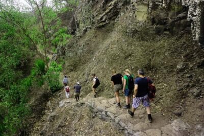
Santiago Island: Serra Malagueta & Tarrafal Beach Trek Tour
Read our review →
Serra Malagueta Natural Park Hike & Relaxing Swim at Tarrafal Beach
Read our review →
Trek from Serra Malagueta to Rabelados Community
Read our review →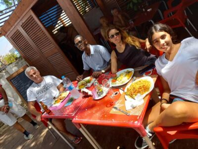
Santiago Island: Trek from Serra Malagueta to Rabelados Community
Read our review →Browse the lists this tour appears in