
Reviewed · SANTIAGO TOURS
Hiking: Monte Tchota Natural Park – Pico D’Antónia (1394m) – Longueira
Cape Verde gets serious uphill here. This six-hour outing from Praia trades city streets for Monte Tchota Natural Park, Santiago Island’s highest summit, and the farm paths of Longueira. I like the mix of hard exercise and real local contact, especially the visit with a family living in mountain homes. I also like that the group is limited to eight people, which should make it easier to keep a sensible pace and ask questions.
The main thing to consider is the difficulty. The route covers about 9 kilometers, includes narrow and sloping paths, and requires a short section of level 1 climbing. You should be fit, comfortable on uneven ground, and ready for a steep descent as well as the climb. Hiking shoes, water, sun protection, and walking sticks are not optional extras here.
In This Review
- Key points to know before booking
- Why this hike is different from a simple summit walk
- From Praia to Monte Tchota Natural Park
- The climb to Pico D’Antónia at 1,394 meters
- The summit picnic and the value of a proper pause
- Descending through farms and Longueira
- A local family visit in Longueira
- Guides, group size, and the feeling of safety
- What the $98.72 price buys you
- What to bring for this 9-kilometer route
- Who should book this hike?
- Should you book Monte Tchota and Pico D’Antónia?
- FAQ
- Where does the Monte Tchota hiking tour start?
- How long does the experience last?
- How far is the hiking route?
- How high is Pico D’Antónia?
- How difficult is the hike?
- What should I bring?
- Is the activity suitable for children?
- What happens if bad weather cancels the hike?
Key points to know before booking
- Reach Santiago’s highest point: Pico D’Antónia rises to about 1,394 meters, often described as the 1,400-meter summit of Santiago Island.
- Expect a one-way mountain route: The walk includes roughly 660 meters of ascent and up to 1,280 meters of descent.
- Share a picnic at the summit: A packed meal gives you time to rest and enjoy the views, weather permitting.
- Meet a Longueira family: The final section brings you through agricultural fields and homes carved into the mountain.
- Count on personal guiding: Cátia and driver Nilton have been praised for keeping a steady pace, allowing rest stops, and answering questions about Cape Verde.
- Pack for changing trail conditions: From August through October, hiking pants are highly recommended, along with sturdy shoes and walking sticks.
Why this hike is different from a simple summit walk
Many mountain excursions are mainly about reaching the top, taking a few photos, and heading back down. This one has a wider purpose. You begin in protected natural surroundings, cross farmland, and finish in Longueira, where daily life is tied closely to the slopes.
That makes the route feel like a cross-section of Santiago Island. The mountain gives you plants, birds, open views, and physical challenge. The lower section shows how people grow food and live in places where flat ground is scarce.
I particularly like the route design because it is not simply an uphill-and-back trek. You climb toward Pico D’Antónia, then descend through agricultural areas and mountain homes. The one-way format lets you see more of the region, though it also means the descent needs just as much respect as the ascent.
The tour begins with a hotel pickup in Praia at 8:30 a.m. The drive to the park is included in the overall timing, and the return transfer brings you back to your hotel after the walk. Plan on roughly six hours from pickup to drop-off, with about four to five hours spent walking.
More Hikes in Santiago
- Serra Malagueta: Principal Valley Hike & Lunch with Locals
★ 4.7 · 64 reviews - Praia: Baobab Mysterious Tree, Green Valley & Old City Hike
★ 4.8 · 53 reviews - Santiago: Calabaceira Valley Trek & Visit to Cidade Velha
★ 4.8 · 49 reviews
From Praia to Monte Tchota Natural Park
The morning starts simply: pickup at your hotel in Praia, followed by the drive toward Monte Tchota. The transfer is useful because you do not need to arrange separate transport to a remote starting point or worry about where the trail ends.
Once the hike begins, the setting changes quickly. You leave the city behind and enter a protected area described as unspoiled, with native plants and birdlife along the route. The guide’s role matters here. You are not only walking uphill, but also learning what you are seeing and how this highland area fits into Santiago’s environment.
The information provided does not promise specific bird species or a particular bloom season, so keep your expectations sensible. You may see endemic plants and birds, but nature does not follow a schedule. Weather and season will shape what is visible.
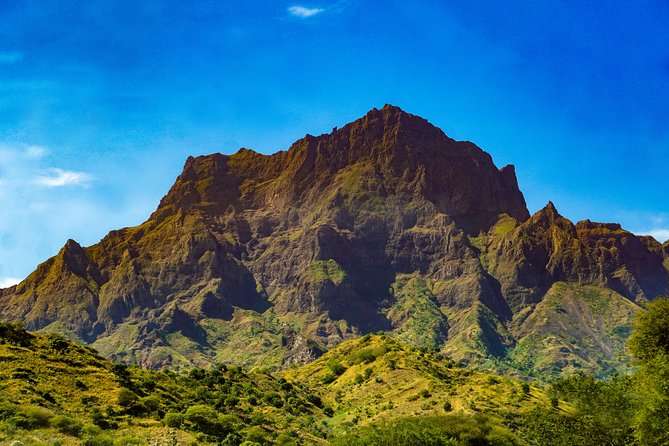
The walking point of Pico D’Antónia is about 4.2 kilometers into the route. That distance may not sound huge, but the elevation gain changes the effort. The total climb is listed at about 660 meters, and the paths can be narrow, sloping, and uneven.
The climb to Pico D’Antónia at 1,394 meters
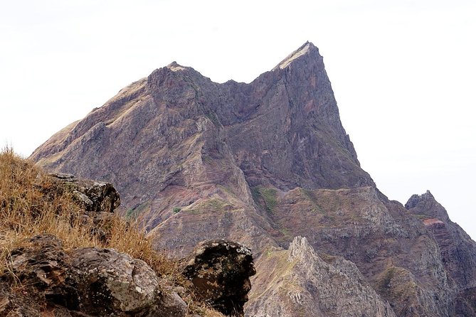
Pico D’Antónia is the physical high point of the day and the highest point on Santiago Island. The summit elevation is given as 1,394 meters, often rounded to 1,400 meters in the tour description.
This is not a gentle viewpoint reached by a short walk. The route is rated difficult, and some sections require level 1 climbing over steep rocks. You will need to place your feet carefully and use your hands in spots. That is why proper hiking shoes and walking sticks are recommended.
The guide helps make this kind of route more manageable. Cátia, one of the named guides, and Nilton, the driver, received especially strong praise for their calm support. The useful detail is not just that they were friendly. They kept a steady pace, made room for rest, and helped the hiker feel safe throughout the day.
That steady pacing is important for a climb like this. A guide who rushes can turn a demanding walk into a miserable one. A guide who watches your pace can help you reach the summit with enough energy left to enjoy it.
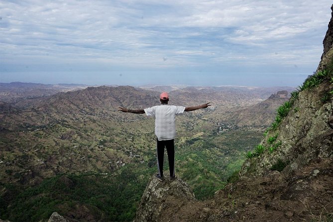
At the top, the reward is broad mountain scenery, weather allowing. On a clear day, you might even see Fogo Island and its volcano far across the horizon. This is not guaranteed, so treat it as a bonus rather than the main reason to book.
Cloud, wind, and visibility can change the view. Even if the distant island remains hidden, you still have the satisfaction of reaching Santiago’s highest point and a picnic break waiting for you.
The summit picnic and the value of a proper pause
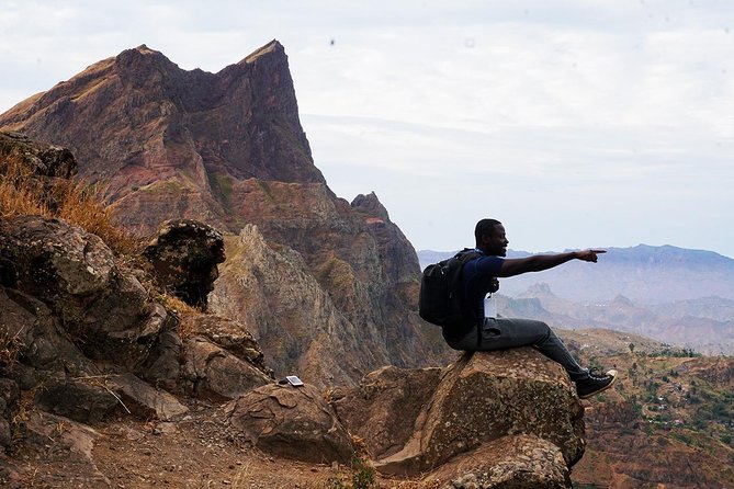
The picnic lunch is a small but important part of the experience. After a difficult climb, food and time to sit down can make the difference between enjoying the summit and simply enduring it.
You get a chance to catch your breath, look across the mountain country, and let the group settle before beginning the descent. I like that the lunch is placed at the top rather than treated as a quick roadside stop. It gives the summit a purpose beyond a photograph.
Bring your own water as instructed. The tour information specifically asks you to carry water, a hat, and sunscreen. Do not assume the picnic replaces your personal supplies, especially during a four-to-five-hour walk.
The summit is also where weather matters most. If conditions are poor, the panoramic view may disappear, and the activity itself can be canceled for safety. In that case, you are offered another date or a full refund. That policy is reassuring, but it also means you should keep some flexibility in your schedule.
More Hikes in Praia:
- Santiago: Monte Tchota Natural Park to Pico d’Antónia Hike
★ 4.8 · 43 reviews - Serra Malagueta Natural Park Hike & Relaxing Swim at Tarrafal Beach
★ 5.0 · 30 reviews - Serra Malagueta Natural Park: Hike to Gongon Valley & Lunch
★ 4.8 · 22 reviews - Santiago Island: 4-Hour Calabaceira Valley Hike & Guided Tour to Cidade Velha
★ 5.0 · 18 reviews
Descending through farms and Longueira
The descent is a major part of the day, not an afterthought. The route lists about 1,280 meters of elevation loss, which is considerably more demanding than the climb might suggest. Descending steep, rocky ground can tire your legs and put stress on your knees.
After the summit, you move through agricultural fields. Depending on the season, you might see corn, mangoes, coffee, or tomatoes growing. This section helps explain how people use Santiago’s mountain terrain for food production. The crops will vary, and the route will not look exactly the same in every month.
August through October deserves special attention. Hiking pants are highly recommended during this period, according to the tour details. The advice suggests that trail conditions or vegetation can make leg protection useful. Pair them with sturdy hiking shoes rather than casual sneakers.
Walking sticks can help with balance on the descent. They are particularly useful on the listed narrow and sloping paths, where a misplaced step can be more serious than on a broad trail.
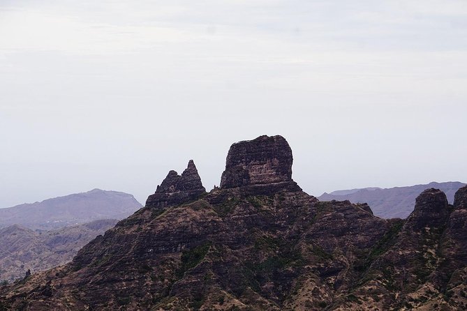
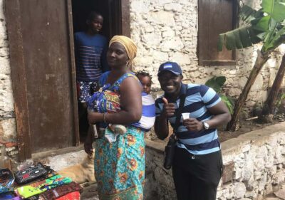
The route finishes in the Longueira mountains, among local homes carved into the rock and slopes. This is one of the most distinctive parts of the outing. Instead of returning straight to Praia after the summit, you see how residents use the mountain as both a home and a source of food.
A local family visit in Longueira
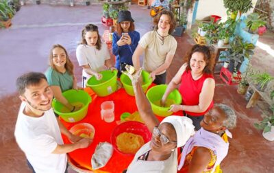
The visit with a local family gives the hike a human focus. You have the chance to hear about daily life and culture directly from people living in the area.
The supplied details do not promise a formal meal, workshop, or performance, so you should not expect a staged cultural show. The value is simpler: a conversation and a look at ordinary life in a remote mountain setting.
That kind of meeting works best when you arrive with curiosity and respect. Ask questions, listen carefully, and remember that the family is sharing its home and routine, not presenting a museum display.
For me, this is what gives the experience more weight than a standard mountain transfer. You see crops in the fields, houses shaped by the terrain, and people adapting to the place around them. The summit is memorable, but Longueira is where the day becomes personal.
Guides, group size, and the feeling of safety
The maximum group size is eight people. That is a strong number for a demanding route. A small group reduces waiting on narrow sections and gives the guide a better chance to monitor everyone’s pace.
Cátia and Nilton are specifically associated with warm, attentive service. Cátia answered questions about the country and offered recommendations, while Nilton handled the driving. Their reported strength was not showy guiding, but sensible care: a steady pace, frequent chances to rest, and reassurance on the trail.
You should still take responsibility for your own limits. The experience is intended for people over 16 with good physical fitness and no health problems. It is not described as suitable for anyone needing an easy, flat walk.
If you are unsure about your fitness, pay attention to the route figures. About 9 kilometers may sound moderate, but the narrow trail, climbing section, steep descent, and large elevation change make this a serious half-day outing.
What the $98.72 price buys you
At $98.72 per person, this is not the cheapest way to spend a day near Praia. Its value depends on what you want from a Cape Verde excursion.
You are paying for hotel pickup and drop-off, a local guide, the driver, access to a difficult mountain route, a summit picnic, and a small-group format. You also receive a more complete picture of Santiago than you would get from a viewpoint stop or a short nature walk.
The price makes the most sense if you would otherwise need to arrange private transport, find a local trail guide, and organize food yourself. It is less appealing if you are mainly looking for a scenic drive or a gentle walk.
Group discounts may be available, which could improve the value for families or friends traveling together. The activity is booked, on average, 27 days ahead, so I would not leave it until the last minute if your schedule is fixed.
Free cancellation is available up to 24 hours before the start time. Changes or cancellations inside that window are not accepted for a refund. Since the outing depends on good weather and a minimum group size, the operator may also cancel and offer another date, another experience, or a full refund.
What to bring for this 9-kilometer route
The packing list is short, but every item has a job:
- Hiking shoes with reliable grip
- Hiking pants, especially from August through October
- Walking sticks for uneven and steep sections
- Water for the full walk
- A hat and sunscreen
- A reasonable level of fitness and patience
Do not dress for a casual sightseeing bus trip. You will encounter narrow paths, sloping trail surfaces, steep rocks, and a short climbing section. Comfortable clothing that allows you to move freely will help.
The tour details do not give a separate gear rental option, so bring the items you need with you. The walking duration is estimated at four to five hours, and the route has both substantial ascent and descent.
Who should book this hike?
I would recommend it to active visitors who want to see Santiago through nature, farming, and local community life. It suits you if reaching the island’s highest point sounds exciting and you are happy to work for the view.
It is also a good match if you prefer a small group and want a guide who can explain local life instead of simply leading from the front. The family visit in Longueira adds something that a summit-only walk would miss.
I would be cautious if you have health problems, dislike steep descents, or normally choose easy walking routes. The tour is rated difficult, and the large elevation loss deserves more attention than the headline summit height.
Should you book Monte Tchota and Pico D’Antónia?
Book this tour if you want a demanding but varied day beyond Praia. The strongest reasons are the small group, careful guiding from Cátia and Nilton, the summit picnic, and the unusual finish among Longueira’s mountain homes and farms.
Skip it if you want a relaxed sightseeing trip or if your fitness is not strong enough for narrow trails, level 1 climbing, and a long descent. For the right walker, the $98.72 price buys much more than a mountain view: it connects Santiago’s highest ground with the plants, crops, homes, and people below.
FAQ
Where does the Monte Tchota hiking tour start?
Pickup is offered from your hotel in Praia. The scheduled start time is 8:30 a.m.
How long does the experience last?
The full activity takes about six hours, including hotel pickup, the hike, and the return transfer to Praia. Walking time is approximately four to five hours.
How far is the hiking route?
The route covers about 9 kilometers in total. It is a one-way trail rather than a walk that returns along the same path.
How high is Pico D’Antónia?
Pico D’Antónia reaches about 1,394 meters, often rounded to 1,400 meters. It is the highest point on Santiago Island.
How difficult is the hike?
The route is rated difficult. It includes about 660 meters of elevation gain, around 1,280 meters of elevation loss, narrow and sloping paths, and sections requiring level 1 climbing.
What should I bring?
Bring hiking shoes, water, a hat, sunscreen, and walking sticks. Hiking pants are highly recommended from August through October.
Is the activity suitable for children?
The activity is intended for people over 16 years old. It is suitable for walkers with good fitness and no health problems.
What happens if bad weather cancels the hike?
If poor weather causes cancellation, you will be offered a different date or a full refund. The same options apply if the minimum number of participants is not reached.
Just added in Praia
- Santiago Island: Private Airport Transfer to Praia or Vice Versa★ 5.0 · 3 reviews
- Hiking Águas Belas Cave★ 4.5 · 3 reviews
- Best of Santiago Island: Cidade Velha, Workshop & Tarrafal Beach Tour★ 4.5 · 3 reviews
- Tarrafal Beach Tour: Boat Trip to the Lighthouse, Snorkel & BBQ Lunch★ 5.0 · 5 reviews
- Santiago island & Full Day Island★ 5.0 · 2 reviews
- Santiago Island: Trek from Serra Malagueta to Rabelados Community★ 5.0 · 2 reviews
- Santiago Island: Longueira, Pico de Antónia & Monte Tchota Trek★ 5.0 · 1 review
- Hiking Serra Malagueta Natural Park★ 5.0 · 2 reviews
Santiago Tours, compared.
Santiago Island Tour with Tastings and Tarrafal Beach
Read our review →
Santiago Island Tour: Meet with a Local Family & Tarrafal Beach
Read our review →
Island tour with German-speaking guide for cruise guests
Read our review →
Santiago Island: Highlights of Cidade Velha with Local Guide
Read our review →Browse the lists this tour appears in